When someone talks about hiking in Singapore, it sounds like an oxymoron. With more than 5 million people crammed into an island of just 716 square kilometers in area, and buildings of every type just round the corner, it’s hard to imagine any space where you would be able to find a hiking trail. However, Singapore is called the Garden City for good reason, and nature does flourish in togetherness with the city.
The Southern Ridges trail is relatively new compared to the more well trodden trails of Bukit Timah nature reserve and MacRitchie Reservoir. I would classify Bukit Timah and MacRitchie as more geared towards ‘hard core’ nature lovers where the trails lead you right into the primary jungle, and away from civilization. On the other hand, the Southern Ridges trail is rather sanitized, and never lets you forget that civilization is just round the corner. And never will your expensive branded walking shoes touch any mud on this hike.
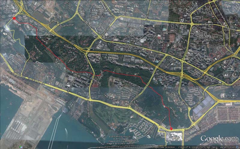
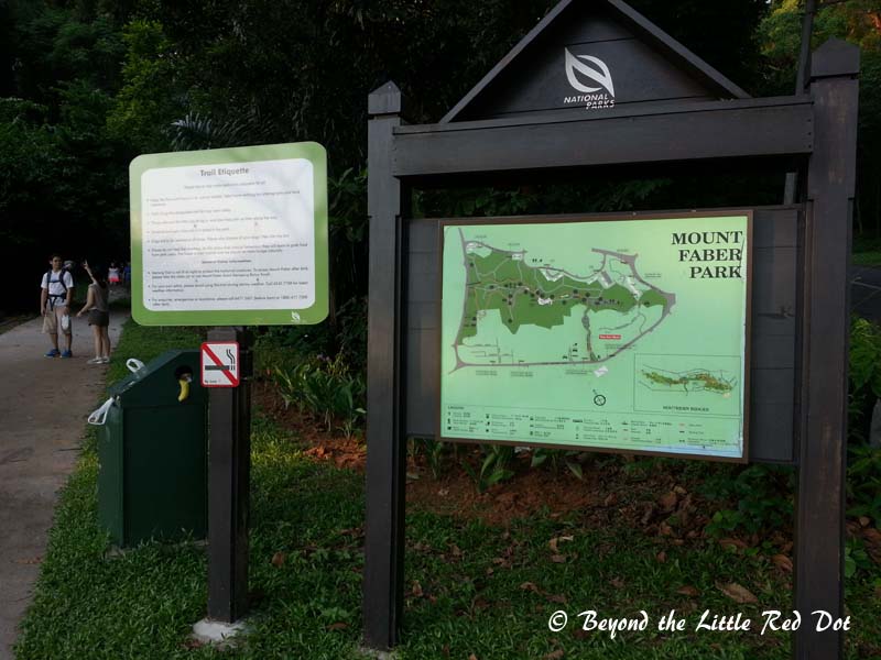
Officially, the Southern Ridges trail starts from West Coast Park and Clementi Woods. However, you can enter the trail from anywhere convenient, so this is how I do it to get the most out of it, and it’s easy for those who are taking public transport too.
The start point for me would be at Kent Ridge MRT station which is on the Circle Line. Getting to Kent Ridge MRT station is easy as the Circle Line connects to all the other main MRT lines at various interchange stations. Once at Kent Ridge MRT station, follow Exit B that leads to Science Park 1. From there, walk to Science Park Drive and follow that road all the way until it ends at Normanton Park. There will be stairs that lead down to a small pond.
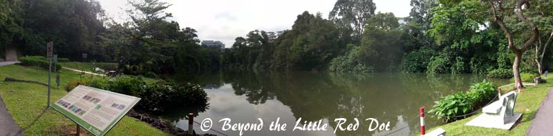
Walking down the stairs to the pond, you will start to leave behind the techie vibes of the Science Park industrial area. From the pond it is a moderate uphill climb to the top of Kent Ridge. Rest assured the climb is all on well paved paths and stairs.

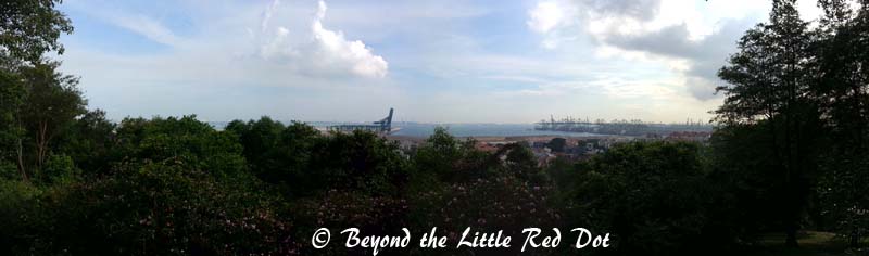
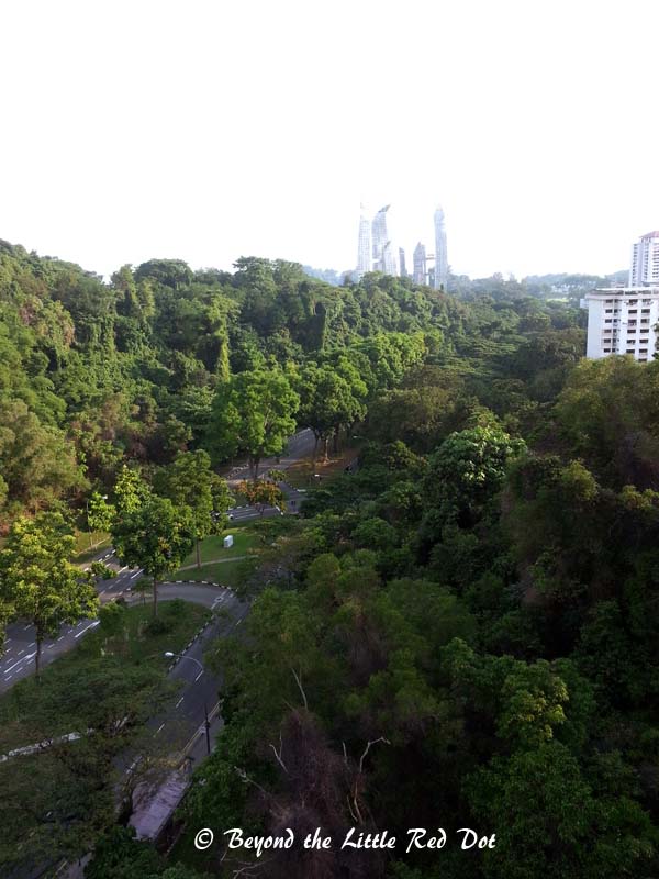
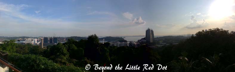
Follow the road as it runs along the ridge line. You would be able to see good views of Singapore’s southern coast line from here.
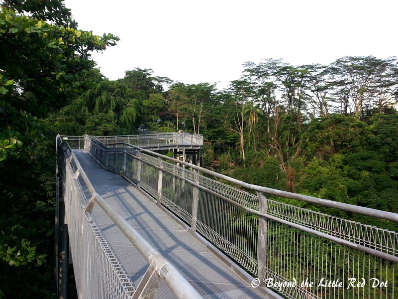
Continue along the ridge line until you enter a small forested area and see the sign that says ‘Canopy Walk’. This would be your first elevated walk among the tree tops.
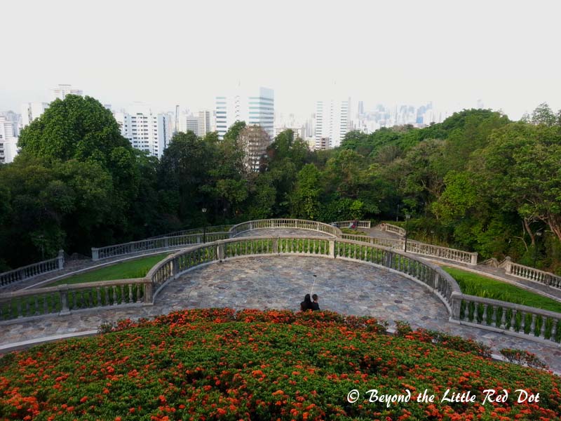
It’s a short 300m walk on the platform and it leads down to HortPark by a winding concrete path. Now, I don’t really understand the purpose of HortPark. The name is a horrible mashup of Horticulture Park and it seems like a showcase of gardening and horticulture concepts. It is a nice place to bring your family and kids to play though.
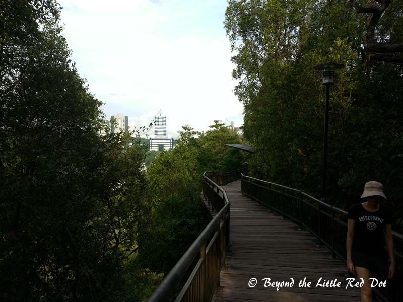
After going through HortPark, you will find yourself at Alexandra Arch bridge which crosses Alexandra Road. This is the start of the ‘Forest Walk’ which rises 18m above the ground and lets you walk among the tree tops.
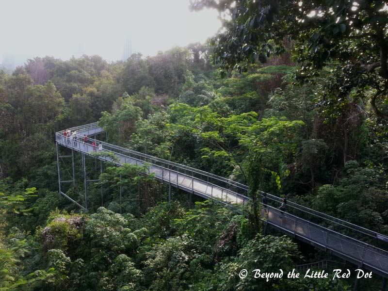
The Forest Walk stretches for 1.3km on elevated platforms. It also climbs upwards and at the end, you will find yourself on Telok Blangah Hill. From here you can follow the road that goes round the hill, or take a short but steep climb up to the summit.
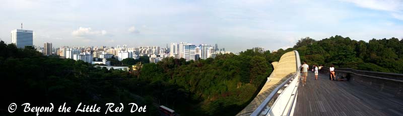
As you come down Telok Blangah hill, you will pass by Alkaff Mansion. It was an old colonial mansion that is now a high end restaurant. Again, follow the path that leads to Henderson Waves Bridge. This is the highest pedestrian bridge in Singapore at 36m above the road level and connects Telok Blangah Hill to Mount Faber.
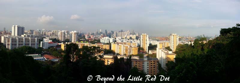
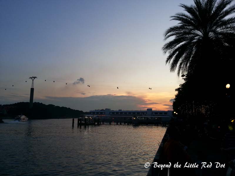
The bridge is a nice place to relax and you will find many people resting and posing for photos here. Continue across the bridge and you will be on Mount Faber, the last hill before the end of the trail. Following the steep and winding road upwards, you will soon find yourself at the summit of Mount Faber. From here you can go up to the Jewelbox and jostle with busloads of tourists for panoramic views.
From Mount Faber, follow the signs that say ‘Marang Trail’. This will lead you down from Mount Faber towards Viviocity Shopping Mall.
Once you reach the bottom of the hill, you will see Vivocity right in front and this will be end point where you can grab dinner and drinks to reward yourself for completing the hike. After dinner, take the subway from Harbourfront MRT station which is right below Vivocity. Alternatively, you can take a taxi or bus back into the city.
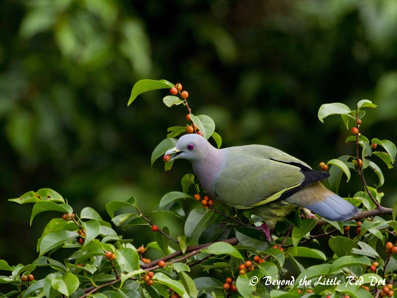
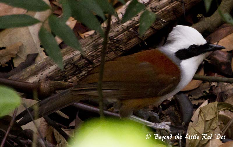
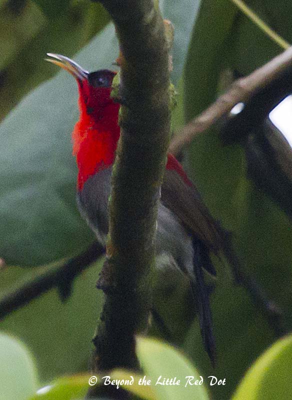
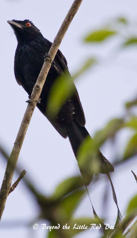
While the Southern Ridges hike is pretty sanitized, you will still get to see plenty of birds and wildlife if you look closely.
Some Notes
This is not a physically demanding hike and most people will be able to do it. Typically it takes 2~2.5 hours if you take a leisurely stroll, and I have completed it in 1.5 hours on a brisk walk. I have also seen parents bring their kids on strollers, so this would be a kid friendly hike.
Evenings would be a good time to go there as you can see sunset from Mount Faber. However, it does get dark especially on the Marang Trail when descending to Vivocity and there are no lights. So time your hike to make use of available light, or bring a torchlight.
Besides starting from Kent Ridge MRT, you can start from Harbourfront MRT instead. The choice is up to your convenience.
If you are tired or decide to end your hike early, there are many places to exit and find your way to the nearest shopping mall, eating place, bus stop or main road.