As the plane flew over the alien landscape, I could see that Iceland was going to be a very different world compared to other destinations. Lava fields extended below me as the plane came in for landing at Iceland’s only international airport at Keflavik. It was the middle of winter and snow covered the lava fields. Jagged black lava formations stuck out of the snow everywhere forming a contrasting landscape of black and white. There is no room for error during landing, miss the runway and the plane would be shredded to bits on the sharp and knife-like volcanic rocks. Building an airport out in the middle of an ancient lava field, what were they thinking?

So what were we doing in Iceland in the middle of winter? Truth is, we wanted to see the Aurora Borealis, or Northern Lights as it’s commonly known. The best time is from October to March, but this also coincides with winter, and for good reason. Winter is the time when daylight hours are the shortest, and skies are generally clear due to the colder, drier weather. But more about the Northern Lights in a later blog post. I thought I would like to start off my blog series on Iceland with an introduction to the landscape. Trying to catch the Northern Lights can be a exercise in futility as viewing them depends on solar activity and good clear weather. If both of these circumstances don’t come together then what else can you do in winter? Enjoying the rest of Iceland, and understanding why it’s called the ‘Land of Fire and Ice’. Another thing about visiting Iceland in winter, it’s the low key season and prices are cheaper for car rentals and hotels, with less crowds. Although in our case, I felt that there was still too many tourists when we were there in February 2016.
Many of us in Asia have probably heard of Iceland. That faraway, mysterious island of the Vikings and elves. In recent history, Iceland was more well known for the collapse of their banks in 2008’s sub-prime crisis, the filming location of Game of Thrones, and more recently, their Prime Minister had to resign because he had a off-shore company hiding his wealth in the ‘Panama Papers’ leak. Most of us also think that Iceland is extremely cold, that’s why they call it Iceland, duh!
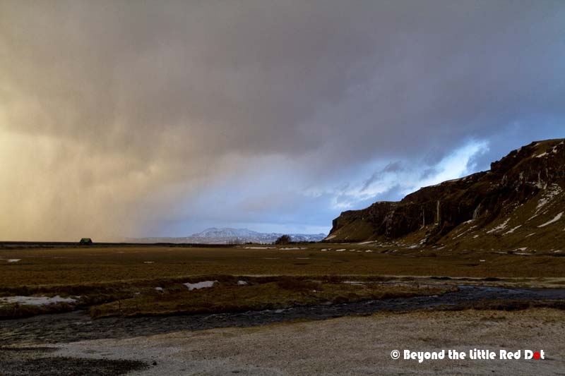
Iceland lies just below the Arctic Circle at the meeting point of the Arctic and North Atlantic Oceans. Due to the North Atlantic Gulf stream which brings warm air and sea current from the south, Iceland does not get very cold even in winter compared to other places at the same latitude. When we were there in February, average temperatures were +5°C to -5°C. However, because of the constant tension of cold and warm air from the Arctic and Gulf streams, the weather in Iceland can change very rapidly. We encountered all manner of seasons in Iceland while we were there, ranging from sunny days to wintry conditions like rain, snow, sleet and hail, not to mention the occasional blizzard.
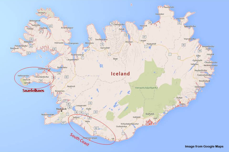
Geologically, Iceland sits between 2 continental plates, the North American and the European plates which are drifting apart slowly. That means Iceland is slowly getting bigger as the 2 continental plates pull apart. Because of plate tectonics, volcanic activity is high here. Thus, we have the Land of Fire and Ice where rumbling volcanos lurk under glaciers waiting to explode into life every few years. And where else to see this than the more popular tours like the Golden Circle, South Coast and Snæfellsnes Peninsular. Another thing, Iceland is also the land of unpronounceable Viking names as we will soon see.
For this blog post, I will talk about the South Coast and Snæfellsnes Peninsular, both of which can covered by a day tour, or an extended tour over a few days for a more thorough experience. The Golden Circle will be covered in a later blog post. As it was winter, we were advised by the Icelanders not to self-drive as far as possible, especially if we come from tropical Asia and have no experience driving in snowed out roads and coping with blizzards (Despite the snow and ice, I never saw any Icelanders using chains on their tyres when I was there). Thus, we took guided day tours which although lacks some freedom, but with helpful tour guides who are more than willing to share their country with the rest of the world, made the tours great.
South Coast
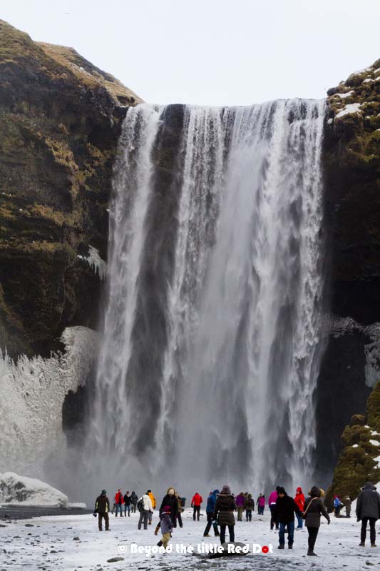
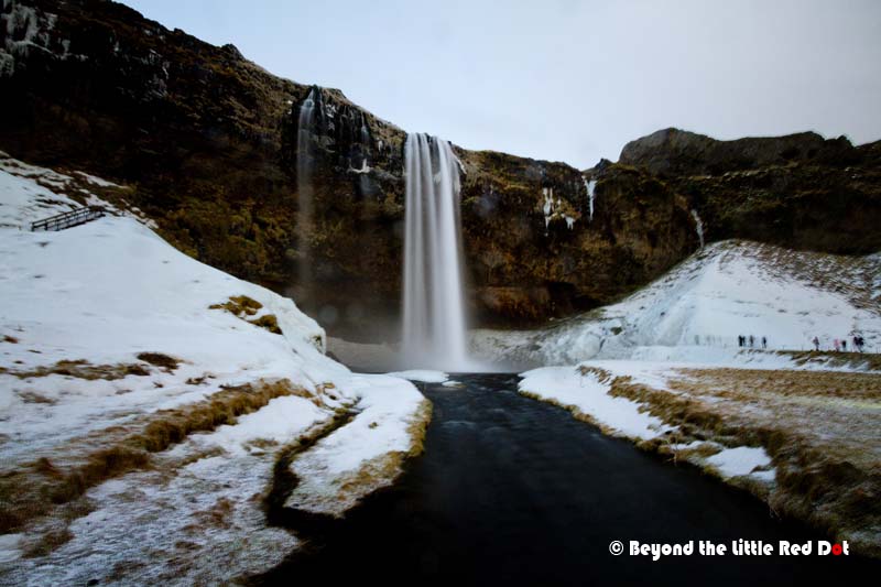
If you want to see waterfalls, black sand beaches and glaciers, then the South Coast is the place. Extremely popular due to it’s easy road access from Reykjavik, the attractions along the South Coast can get pretty crowded with tourists. But this was winter, and when I say crowded, it just means less than a hundred tourists at any of the attractions at any one time.
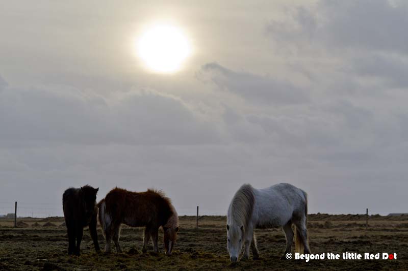
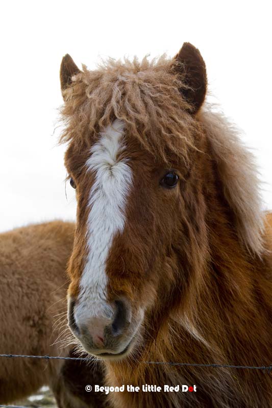
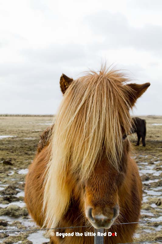
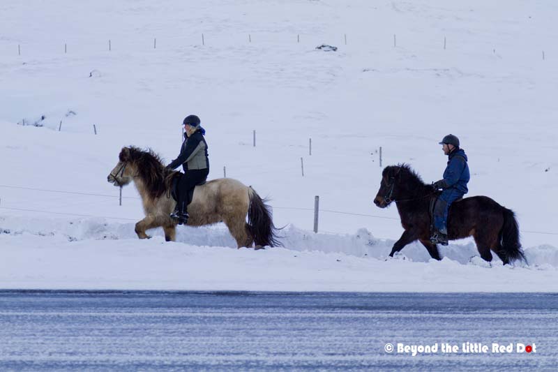
Along the way, we came across the Icelandic horses which are plentiful and often seen in the pastures by the road side. They are quite friendly and would come up to people just to get some attention. They were sporting their winter coats consisting of long manes and hair over their bodies. Although the size of a pony, they are extremely strong and hardy.
Culturally, many Icelanders also believe in elves and will try their best not to disturb rocks that are believed to be their homes. So after one of our tour mates asked a question on elves, our tour guide brought us to see an elf castle.

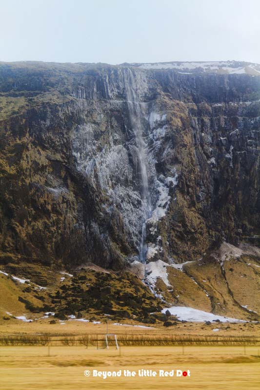
There are a couple of prominent waterfalls along the South Coast like Skógafoss and Seljalandsfoss, all of which make good photo stops.


Along the way, we also stopped at one of the more famous volcanos in recent history, Eyjafjallajökull, the mountain who’s name cannot be mentioned. As stated earlier, Iceland is a land of unpronounceable Viking names and Eyjafjallajökull is one of them. When it erupted in Aril 2010 and caused the shutdown of air travel in Northern Europe for months, news reporters were having problems trying to pronounce the name of the volcano.

We passed by the small village of Vik and stopped for lunch. Despite it’s small size (less than 300 residents), Vik is quite popular with visitors and has a rather large hotel for it’s size. Most people stop here to see the black sand beach or break their journey as they continue to the eastern part of Iceland.

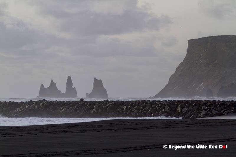
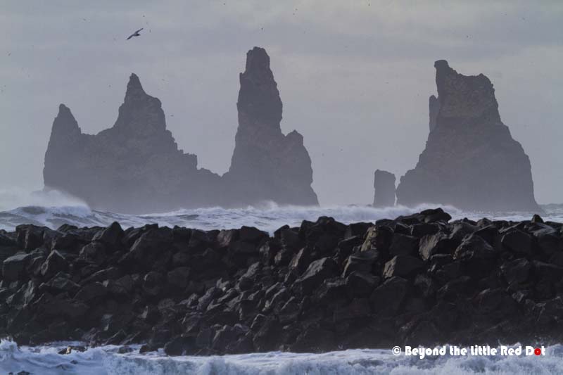


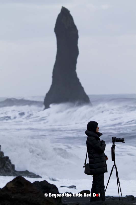
After lunch, we drove around the cliffs to another black sand beach were could get a closer look at the basalt cliffs and rock formations. The black sand beach can be quite dangerous as our guide told us that a Chinese tourist was killed just a few days ago when he stood too near the waves and got washed out into the ocean and drowned. When we were there, we could see a heavy police presence as they tried to keep over enthusiastic tourists from venturing too close to the waves.


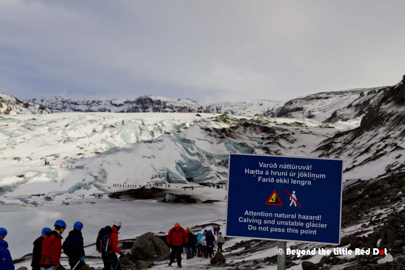
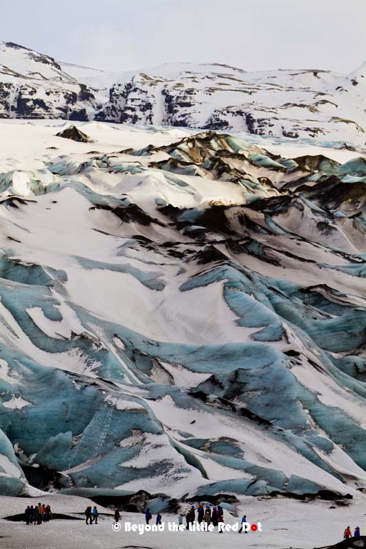
Vik itself lies under the shadow of another volcano covered by a glacier. This one is called Katla and the glacier covering it is called Mýrdalsjökull. Another mouthful to pronounce and I have already given up on speaking Icelandic. So after leaving Vik, we found ourselves taking a walk onto the lower reaches of Mýrdalsjökull glacier. Katla, the volcano under Mýrdalsjökull is bigger and more active than Eyjafjallajökull, and it has not erupted for the last 100 years. Scientists predict that it is overdue for a major eruption.
Our tour of the South Coast took a whole day. We left in the early morning around 9am and were back in Reykjavik by 7pm. Our tour group was quite small with around 15 of us. I think this is a good group size compared to a large tour bus with 40-50 people. There was more flexibility in the itinerary like stopping to see the Icelandic horses and elf castle and we had a more intimate interaction with the guide. Although we seemed to have seen quite a few sights, there are many more sights like the famous wreckage of a US Navy DC-3 aircraft on the rocky beach that we didn’t get to see.
Snæfellsnes Peninsular
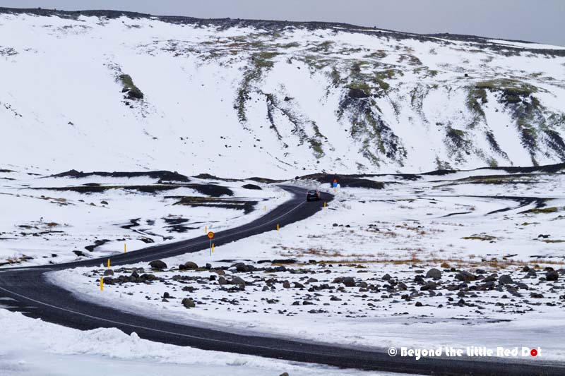
On the western side of Iceland is the Snæfellsnes Peninsular. It’s not a typo and your eyes are not playing tricks on you, the ‘a’ and ‘e’ are joined together. This is one of the few Icelandic names that I can pronounce. Also called Iceland in Miniature, Snæfellsnes has a much different look compared to the South Coast. We also took a day tour for this, but it was a super long 13 hours day tour. We left at 7am and only got back by 9pm. The total distance travelled from Reykjavik isn’t that far, probably a 150km round trip, but the mountainous terrain meant that the tour bus couldn’t go fast. After a brief stop at Bogarnes, a small town for some refreshments and toilet break, we drove for another hour or so before reaching our first stop, Ytri Tunga beach.

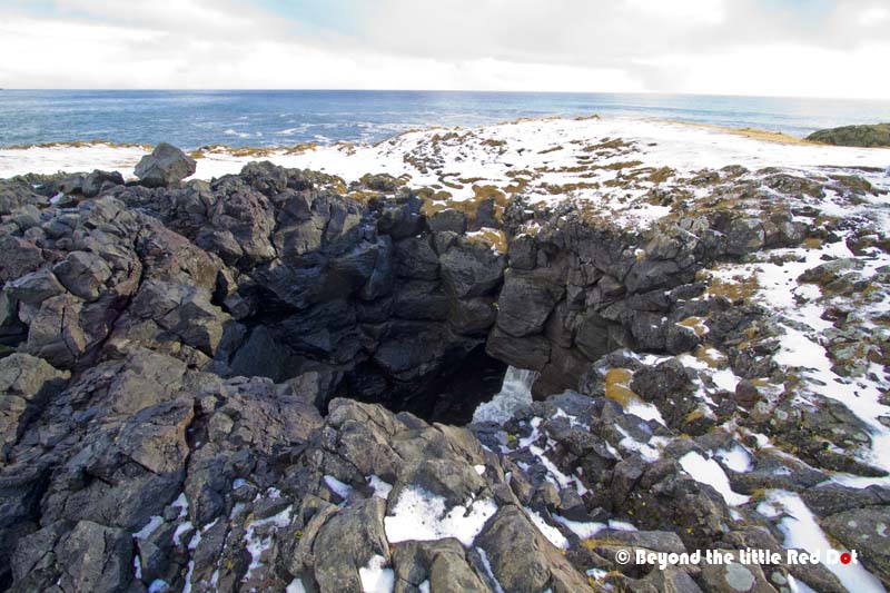
After more driving, we came to the small village of Hellnar. This is one of many small fishing villages which dot the Snæfellsnes Peninsular. Hellnar is probably more popular as it boasts some spectacular cliffs and blowholes along it’s coast.


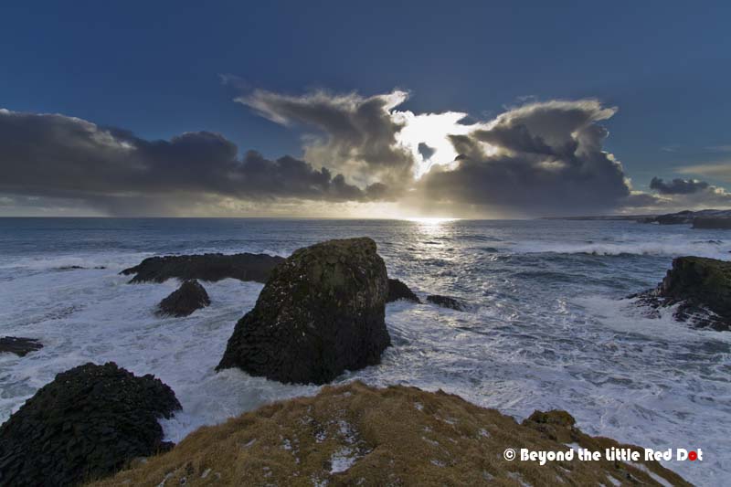
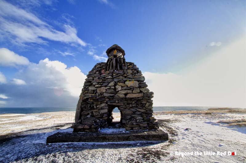
From Hellnar, we drove on to the main fishing village of Anarstapi where we got down to walk along the coast and look at the eroded rocks which have formed into blowholes and arches. Legend has it that a half-man, half-ogre named Barður Snæfellsás still inhabits the area and protects the village from evil.


After Anarstapi it was another long drive along the Snæfellsnes coastal road to the northern side of the peninsular. All this while we could sometimes get a glimpse of Snæfellsjökull, the huge strato-volcano and glacier from which the peninsular gets it’s name. Snæfellsjökull is famous because in the novel ‘Journey to the Centre of the Earth’ by Jules Verne, the heroes enter the crater of Snæfellsjökull to get to the Earth’s core. So is there really a way to get to the centre of the Earth from Snæfellsjökull? I wonder…
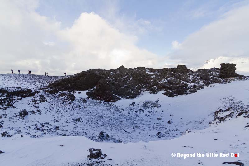
Our next stop was Saxholl, a small volcano which last erupted more than 3,000 years ago. All that’s left of it is a small crater and the lava field around it. It’s not very high, just about 109m and has a metal staircase which winds it’s way to the top. So it is an easy climb although with frozen ice along some of the sections, we had to be careful with our footing.


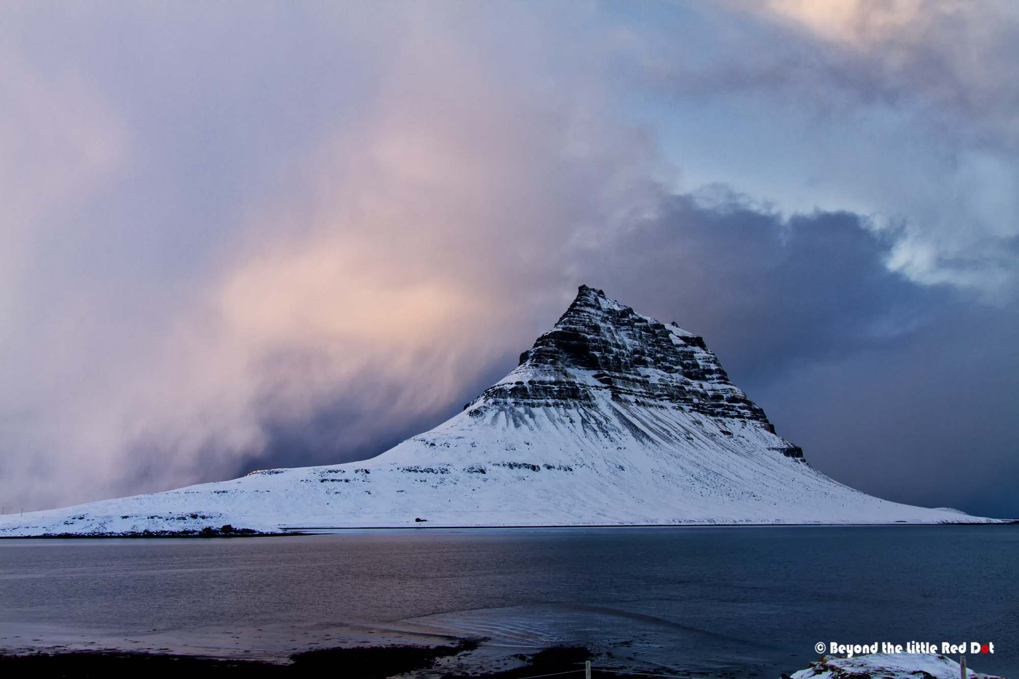
Days are short in winter and our tour guide was already rushing to reach our last stop before it got dark. Finally, the highlight of our Snæfellsnes tour was the mountain of Kirkjufell (463m). This is one of the more famous and picturesque mountains in Iceland, appearing in films like ‘The Secret Life of Walter Mitty’.
It was already getting dark and we still had a long 3 hours drive back to Reykjavik. It was time for a long nap after a tiring day of touring. We soon found ourselves back at Bogarnes where we had stopped in the morning and that felt like it was a long time ago. Again, I do think that a day tour was too short to fully appreciate Snæfellsnes and all it has to offer. One of the places that we could did not have time to go to was Grundarfjörður which is just next to Kirkjufell. This small fishing village is well known for Orca (killer whale) watching in February and they organize cruises from there.
Getting to Iceland
There are no direct flights from South-East Asia to Iceland and for most purposes, travelers will need to transit somewhere in Europe to catch a connecting flight to Iceland. Popular choices for transiting are London, Amsterdam, Copenhagen and Helsinki as these are nice cities for stopovers. There many choices of flights from mainland Europe to Iceland ranging from Icelandair, Ryanair, WOW Air, EasyJet, etc. Again booking early and during non-peak periods will save you a ton of money in airfares.
Land Tours
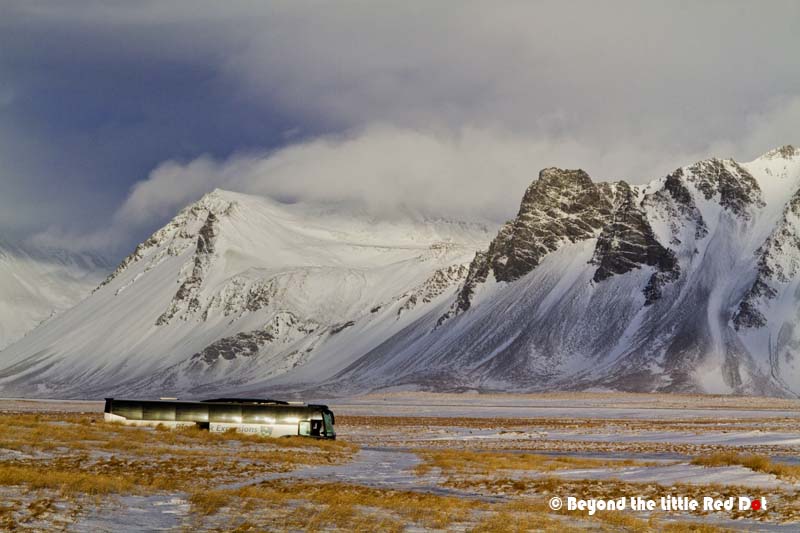
There are many land tour operators in Iceland and we booked our tours through the Tourist Information Centre in Reykjavik. Most of the prices are about the same and it just depends on availability and small differences in itinerary. The 2 largest land tour operators are Grayline and Reykjavik Excursions, although there are a few other smaller operators. I would say that the smaller groups sizes are my preferred choice as it is less cramped on the mini-bus compared to large groups in tour coaches, and they have some flexibility in itinerary because they don’t have to wait so long for large groups during stops. However, the smaller tour operators may not run the tour if they do not have enough people to fill their bus compared to the 2 major operators which are usually more popular. You can check on the group size at the Tourist Information Centre when making your booking.

What a dream destination this must be… The photographs are amazing, but what astounds me is the diversity and a sense of silent beauty in your photos. Just awesome.
Lovely post with helpful information. Your pictures ar so beautiful!
Thank you for your appreciation 😊