There are road trips, and then there are Road Trips. These are the road trips that offer fantastic scenery, unique stop overs and a drive like no other. Some of them are even world famous like the Great Ocean Road in Australia with its rugged coastline and scenic bends.
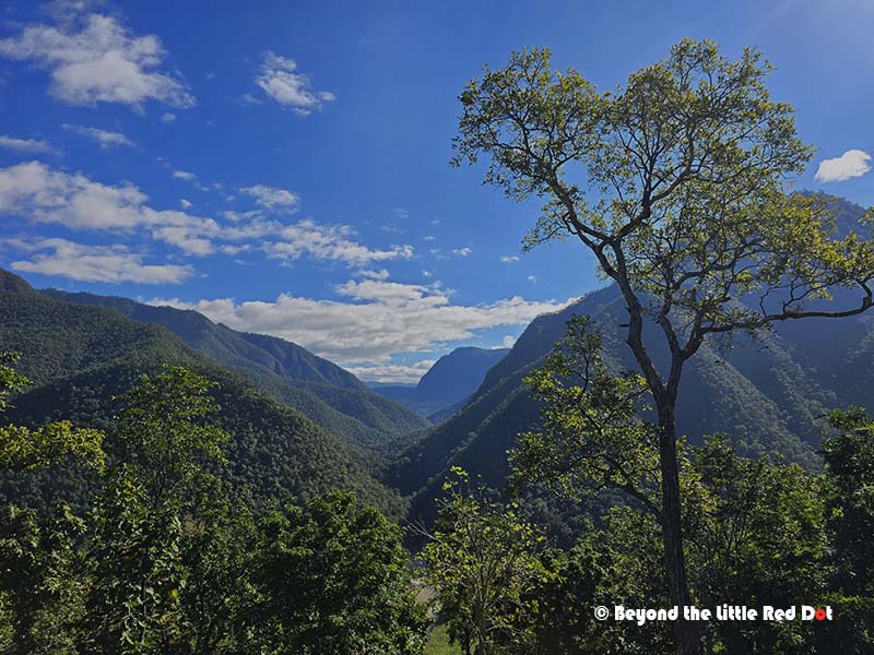
In Southeast Asia, the Mae Hong Son Loop is probably one of Thailand’s greatest road trips. Especially popular with motor cyclists, its a circuit of more than 600 km winding its way through the mountains of Northern Thailand. The route starts and ends in Chiang Mai. Along the way, you will see misty mountains, quaint villages tucked in valleys, cozy home stays and esoteric cafes. Being a loop, you can travel in any direction; clockwise or anti-clockwise.
I had traveled part of the Mae Hong Son Loop in 2022 and visited the town of Pai. I was hooked on making a round trip and made it a point to revisit the whole loop and explore the other stops along the route. In November 2025 I arrived in Chiang Mai again, determined to complete this journey.
The plan was to travel in an anti-clockwise direction from Chiang Mai to Pai; from Pai to Ban Rak Thai near the Thailand-Myanmar border; then head south to Mae Hong Son City; followed by a stop over at Mae Chaem town; before heading back towards Chiang Mai with site seeing stops at Doi Ithanon along the way. I also planned to stay 1 to 2 nights at Pai, Ban Rak Thai, Mae Hong Son and Mae Chaem, thus breaking up the long journey into manageable segments whilst enjoying the stop overs. The entire journey took me 8 days for a round trip.
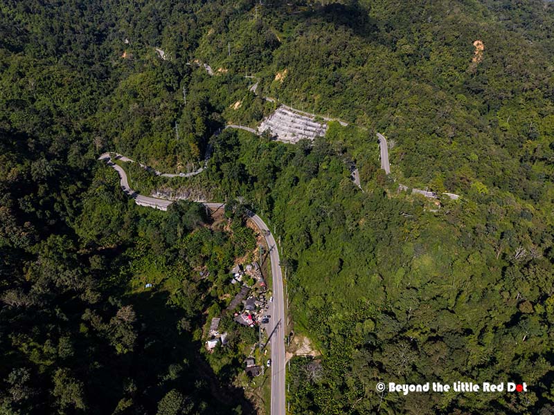
You can loop clockwise or anti‑clockwise and still see the same key places, but starting with Pai and ending via Doi Inthanon changes how the trip feels. Going anti‑clockwise means you hit the hipster tourist town of Pai first, then gradually trade crowds for quieter mountain villages and national parks as you work your way south and back to Chiang Mai. At the same time, the route from Chiangmai to Pai is easily the most curvy segment with steep climbs, so its best to tackle this while still fresh and not fatigued from long drives.
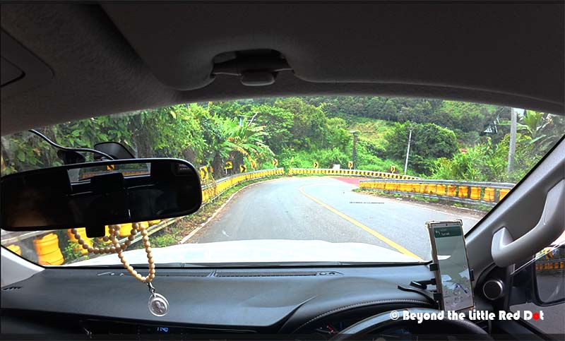
The route is well paved, 2 way and single lane on each side most of the way. In some sections, there are 2 lanes for overtaking. There are no street lights except when passing through villages or towns. Its easy to drive but you have to be confident in driving curvy roads and negotiating tight turns. Some gradients are steep with 8% or more slope but most vehicles including family saloons can make the trip easily. Although I would recommend a larger engine capacity car with 4WD like a SUV for easier overtaking and going up steep slopes.
Chiang Mai to Pai: Of Twists and Turns
Distance: 134 km
Driving time: around 3 hrs
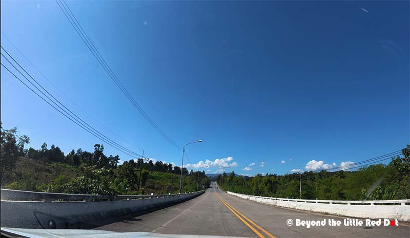
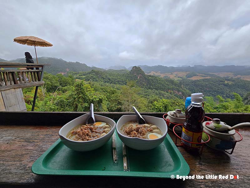
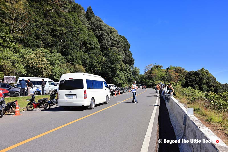
Chiang Mai is the starting point of most trips. Here, you can pick up your rental car at the airport, and also stock up on snacks and refreshment for the drive. If your flight lands in the morning, the city offers a variety of good food options for brunch or lunch. Once you leave the city on Route 107 and then turning into Route 1095, the landscape quickly shifts from urban sprawl to rolling green hills and dense forest.
I’ve covered the road towards Pai in detail in an earlier post. It’s probably the most curvy segment of the route with steep gradients. The drive here is not about speed, but settling into the rhythm of the curves, and you have plenty of places to break for coffee or a viewpoint. The Mae Hong Son Loop is said to have a total of 1,864 turns and the segment from Chiang Mai to Pai itself already has 762 turns!
I’ve covered the town of Pai previously and you can read it here. I’ll put up separate blog posts for the other major towns like Ban Rak Thai, Mae Hong Son and other interesting places.
Pai to Ban Rak Thai: A Tale of Two Villages
Distance: 119 km
Driving time: around 3 hrs
Leaving Pai, the road first winds northwest. On this segment there are several viewpoints and caves to visit. The most famous and visited cave is probably Nam Lod Cave. Many tourists also take a day trip out of Pai to visit this cave. Besides, marveling at the cave itself, you also get to sit on a bamboo raft while a guide paddles the raft through an underground river running through the cave. We decided not to visit the cave since it wasn’t our interest and it would also take up about 2 hrs for the visit.
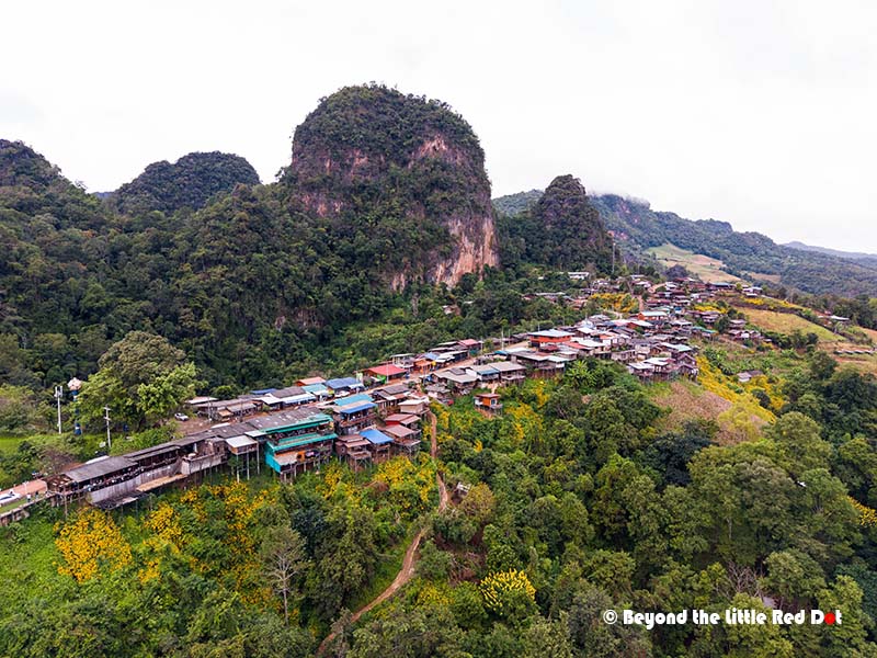
Instead we continued to Ban Jabo, a small hill‑tribe village perched high above the valley with one of the most dramatic viewpoints on the route.
The drive from Pai to Ban Jabo takes around 1.5 hrs and involves a short detour out of the main Loop. After lunch and a coffee break at one of the home stay cafes, its another 1.5 hrs drive to Ban Rak Thai. From Ban Jabo, the road turns southwest until you reach Tham Pla (Fish Cave). You can stop to feed the fishes but we chose to continue. Shortly, from Route 1095 there is turn off heading north to Ban Rak Thai on the Thailand-Myanmar border.
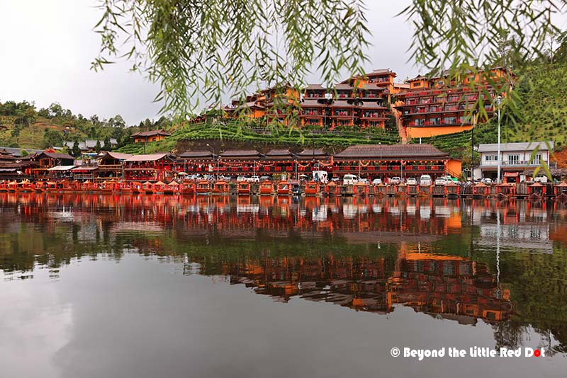
While Pai is a hipster town popular with foreign tourists and backpackers, Ban Rak Thai is a small lakeside village complete with Chinese style tea houses, guest houses and even a small lake with Chinese style boats and tourists dressed in period Chinese costumes (Hanfu). Restaurants serve mainly Yunnanese food and local tea from the nearby tea plantations. You will feel that you are no more in Thailand but in Yunnan.
Post on Ban Rak Thai here.
Ban Rak Thai to Mae Hong Son City: Small City Vibes
Distance: 45 km
Driving time: around 1 hr
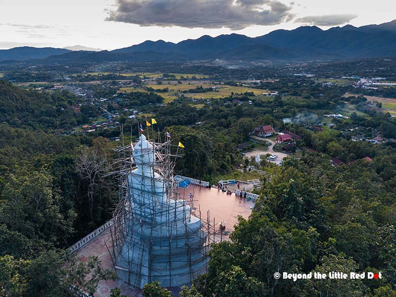
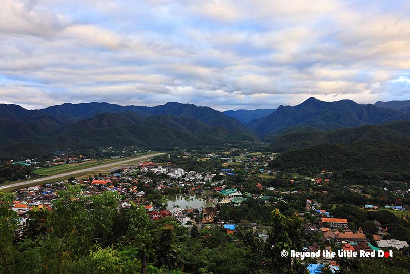
From Ban Rak Thai, we head southwards towards Mae Hong Son City, a compact provincial capital nestled amongst steep hills and ringed by temples. The town’s small man made lake, Wat Chong Kham and Wat Chong Klang create a beautiful scene at sunset when lanterns and reflections turn the water into a mirror.
Post on Mae Hong Son City here.
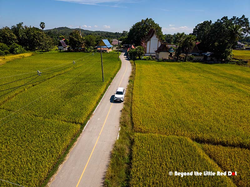
Mae Hong Son City to Mae Chaem: Quiet Roads and Rural Life
Distance: 166 km
Driving time: around 3.5 hrs
From Mae Hong Song City, the road continues south. The official Loop continues all the way south until Mae Sariang before turning eastwards back to Chiang Mai. But we turned east mid way at Khun Yuam Village and headed southeast towards Mae Chaem. The aim was to cover as much distance as possible so that we wouldn’t need to drive a longer distance the next day to Doi Ithanon.
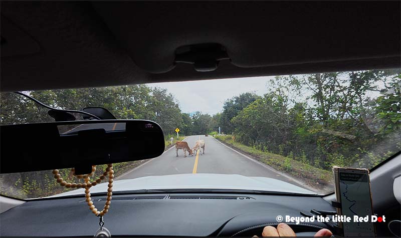
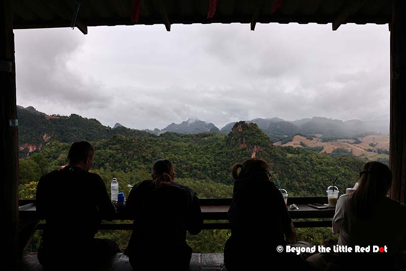
The leg from Mae Hong Son City towards Mae Chaem is less visited than the Pai side of the loop, and it offers a more relaxed drive. The road winds through a mix of forest, farmland and small settlements, with fewer vehicles and a calmer pace. We also visited the Thung Bua Tong Fields at Doi Mae U Kho located around 2 hrs drive from Mae Hong Son City. This is a national park with a huge field of sunflowers which so happens to bloom only in mid November for around 2 weeks.

Post on Doi Mae U Kho here.
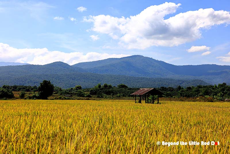
When we reached Mae Chaem, its a small town with rural feel since it is surrounded by rice fields. There are a number of guesthouses and home stays as most travelers use Mae Chaem as a base to explore the surrounding rice terraces and hill villages, or like us, use it as a staging ground to push towards Doi Ithanon. There wasn’t really much to do except rest and get ourselves a nice dinner.
Mae Chaem to Doi Ithanon: Thailand’s Highest Peak
Distance: 30 km
Driving time: slightly less than 1 hr
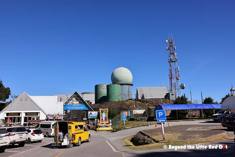
From Mae Chaem, the road to Doi Inthanon climbs steadily into one of Thailand’s most important national parks and home to its highest peak at 2,565 m. As you gain altitude, the temperature drops and the vegetation changes from farmland to dense evergreen forest, before opening out at viewpoints and rest areas along the way.
Doi Ithanon is a national park and has royal agricultural projects, waterfalls, cloud‑forest trails and the photogenic twin pagodas dedicated to the King and Queen. However, I didn’t get to visit the twin pagodas as the road entrance seemed to be blocked, and I would have to park quite far away and walk over. Doi Ithanon gets extremely crowded due to the day tripper tourists from Chiang Mai, so its best to get there early in the morning if you want to skip the crowds. I had trouble finding a parking spot at the lookout point due to the large numbers of visitors and vehicles.

There is a toll gate at the base of Doi Ithanon where you have to pay a fee of THB 300 per person if you are a foreigner and another THB 30 for your car’s entry.
Doi Ithanon to Chiang Mai: Closing the Loop
Distance: 107 km
Driving time: around 2 hrs
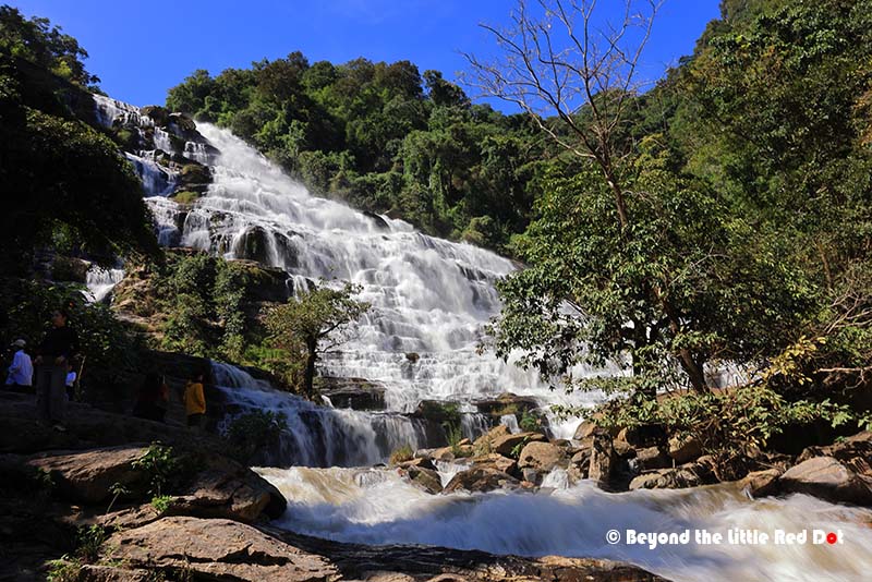
The road from Doi Ithanon to Chiang Mai is pretty easy to drive as it doesn’t have tight curves. I can see that it was built to cater to the high tourist numbers that come here. Before heading straight to Chiang Mai, we made a stop at Mae Ya Waterfall. This waterfall makes a spectacular last stop before you fully leave the mountains behind. Tucked in a forested valley, the falls spread out over a broad rock face in multiple tiers, creating a curtain of white water that feels both powerful and calming when you get close. The short walk in is easy, and there are plenty of spots to sit on the rocks and cool your feet in the water. If you have bought the tickets for Doi Ithanon, don’t throw them away. They will also grant you entry to Mae Ya Waterfall, otherwise you will be charged another THB 300 per person!
After Doi Inthanon, the road gradually descends towards the plains around Chiang Mai, bringing you back to wider roads, more traffic and the sense of re‑joining the hustle and bustle of city life. We merged into Route 108 which leads straight to Chiang Mai and right into rush hour traffic jams. Welcome back to the city!
We had covered more than 650 km including detours and side trips, crossed 2 provinces; Chiang Mai and Mae Hong Son, while experiencing different climates, cultures and natural wonders all in one trip.
