This blog post is all about Big Island. It’s official name is Hawaii, and the whole Hawaiian state and chain of islands that make up the state is named after it. It’s also the largest island and is 3 times the size of Oahu, but only has a population of around 200,000. All the other islands of Hawaii could fit into Big Island comfortably. Although not as exciting as Oahu which hosts the state’s capital, Honolulu, Hawaii offers more in terms of natural beauty and hot lava action. If you are interested in Oahu, you can find out more on my previous blog post.
What are the chances of encountering 2 hurricanes in a week for your vacation? We were supposed to fly to Big Island but the day before our flight a hurricane warning was issued for the whole Hawaiian state. Hurricane Madeline was due to hit Big Island in 2 days time, followed closely by another hurricane, Lester, which will hit later that week. It was a mad scramble as we had to defer our departure, cancelling hotel stays and postponing our flight. What was supposed to be a 5 day stay on Big Island became shortened to a 3 day stay.

So Hurricane Madeline skirted the south coast of Big Island and dumped a ton of rain onto the east coast. All parks and schools on Big Island were closed for 2 days as an emergency measure. By the time Madeline came, it was downgraded to a tropical storm instead of a Cat 3 hurricane. We had avoided Madeline and went to catch our flight to Big Island, hoping that Lester will be a miss.
One thing for sure is that at times like this, I’m glad we purchased travel insurance which helped to mitigate hotel cancellation charges and fees for flight changes.
Getting to Big Island
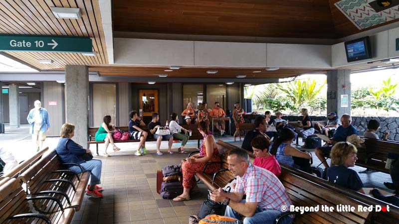
Strangely, although Hawaii consists of islands, there are few commercial ferry services and these only serve the island of Maui and a couple of other nearby islands. Travel between islands is usually by air. It took us 30 minutes just to fly from Honolulu to Kailua-Kona on Big Island. There are several inter-island airline services, and we flew with Hawaiian Air.

Getting Around Big Island
Unlike Oahu, renting a car is the best (and possibly only) option to getting around Big Island economically in terms of time and money. Unless you are just going to park yourself in a resort for the rest of the your stay here, a car is the best way to explore Big Island, as there are no public buses going between towns, and taxis are super expensive. After collecting your luggage and exiting the airport, there are bus stops where shuttle buses will bring you to the respective car rental company counters. These are located quite a distance away from the airport, so walking is not recommended.
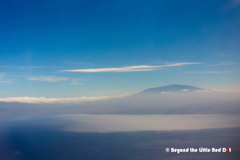
Because we had shortened our trip due to Hurricane Madeline, we decided to only visit the main sights on Big Island (west and south) and skip the eastern parts. We drove to Kailua-Kona which is the largest town on the west side of the island. Big Island’s scenery is dominated by the large volcano, Mauna Loa (4,169m) which makes up more than 50% of the island, the smaller but taller volcano Mauna Kea (4,205m) makes up the rest of the island. Everywhere you go, you are bound to see these two volcanoes in the background. Incidentally, Mauna Loa is the world’s largest volcano, and it rises 5,000m from the sea floor to sea level, before extending all the way to it’s summit. So Big Island is actually the top part of a huge underwater mountain.
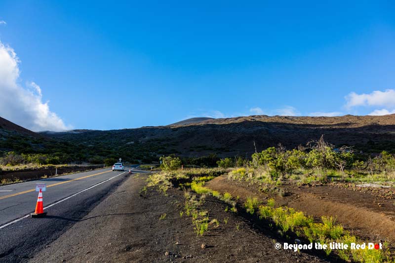
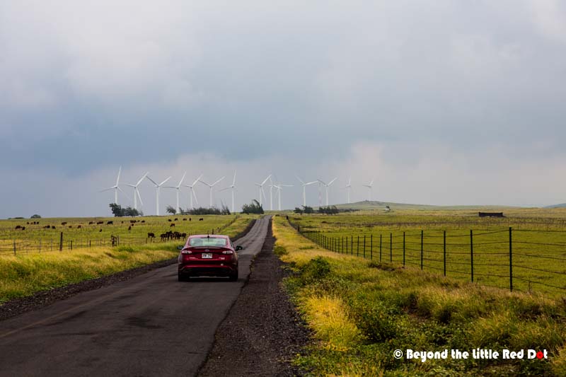
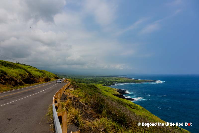
Weather wise, the west side is dry and warm, due to the trade winds that blow from the east after passing over Mauna Loa, cool down and dump their moisture on the eastern side. Thus you will see that west of Mauna Loa, the island is quite warm and dry and this makes it a favorite spot for tourists. You will find most of the resorts and tourists activities here. The eastern side is characterized by heavy rainfall throughout the year and lush tropical jungles with waterfalls falling over high cliffs. There is another airport in Hilo, and depending on your travel schedule, you can fly to Hilo. Visiting the sights on Big Island is basically choosing whether you want to go clockwise, or anti-clockwise, since there is only one main road, Mamalahoa Highway, that circum-navigates the island. There is a newer highway, Saddle Road, that passes between Mauna Loa and Mauna Kea in the middle of the island and is the fastest way to get from east to west, or vice versa.
Our shortened plan was to start from Kailua-Kona, drive anti-clockwise down south to Volcanoes National Park, and then pass through Hilo, and via Saddle Road go to Waikoloa and finally back to Kailua-Kona.
Kailua-Kona
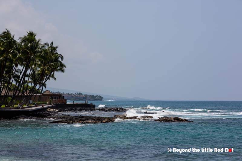
This is the center of tourism in Big Island, since most tourists come to the west side to enjoy the warm and dry weather resulting in lots of commercial activity here. On the eastern side is the main town, Hilo (population of around 44,000), but it is mostly residential where most of the locals live. Kailua-Kona is a small town with a population of around 12,000 residents. There is only one main shopping street called Ali’i Drive which runs next to the coastline. Along Ali’i Drive you would find shops, restaurants and seaside resorts. It stretches from Kailua Bay all the way down to Keauhou.


Mauna Kea Summit
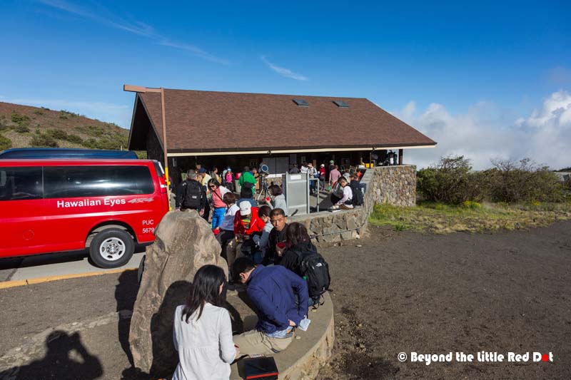
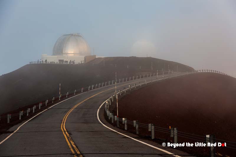
Going up to the summit of Mauna Kea has to be one of the highlights of any trip to Big Island. However, it’s not easy going up there, and I decided to follow a tour with an established company for this. There are several companies offering tours to the summit, and they either leave from Kailua-Kona or Hilo. So you can choose which ones to go with based on your location. Otherwise, you can also go the summit on your own, although there are a lot of caveats to that.
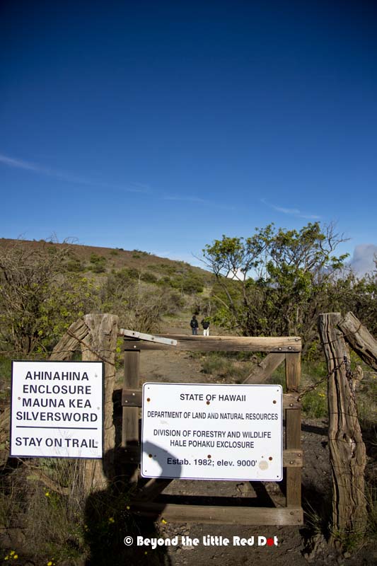
If you rented a compact or sub-compact car, it won’t have the power to climb some of the steep slopes that you will encounter. For rental cars, the rental companies only allow you to drive them to the Visitors Center which is at 9,000 ft altitude. From the Visitors Center, the road to the summit at 14,000 ft is highly recommended to be driven by 4WD vehicles only as it is quite steep and is mostly gravel surface. A normal car engine can overheat trying to go up as there is less air at higher altitudes, and when coming down, continuous braking will overheat your brakes resulting in brake failure. There have been many incidences of tourists damaging or crashing the rental cars this way. When you rent your car, they will tell you that the car rental insurance is void if you decide to drive up the summit and you are liable to pay all damages to the car. There is only 1 car rental company that rents out 4WD jeeps and allows them to go up the summit. So if you want to drive up on your own, look for them.
I had to wait at the designated meeting point for the pickup and the tour started off at 3pm. After picking other passengers at Waikoloa, we started going up the road to Mauna Kea. With it’s dry environment, clear weather almost the whole year and high altitude, Mauna Kea is an ideal spot for astronomy and there are 13 telescopes on the summit operated by 11 countries. I also learned that the top of Mauna Kea is considered sacred by the Hawaiians and they are unhappy that the government has allowed the construction of telescopes on top of their holy mountain. In March last year they held protests and blocked the road to the summit.


After a while, we drove to the view point for sunset. As the sun sets, it gets even colder. I think it was below freezing by then as I could see water puddles starting to turn to ice and my hands turned numbed from the cold if I took off the gloves to handle my camera.


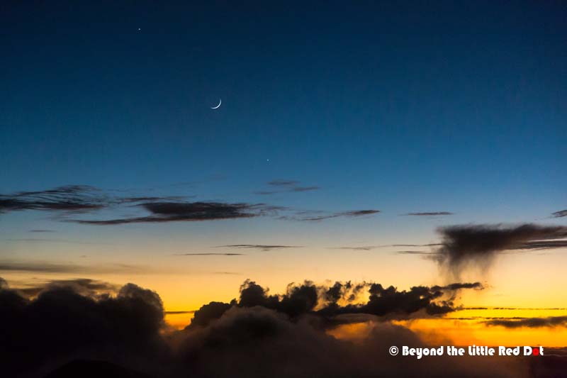
We drove down in the complete darkness until reaching a spot, our tour guide stopped the bus and we all came out for some star gazing. A Celestron telescope was taken out from the back of the bus and set up. Hot cocoa and biscotti were given out, which was really welcomed in the cold. Without any light pollution and with clear skies, I could see the Milky Way stretching above and glowing in the night. This was a wondrous sight as I can never see such a thing in light polluted Singapore. Photographing the Milky Way here was easy, without the need for any special exposure tricks and extensive photo editing.

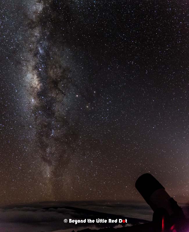
After about an hour of star gazing where we got to see Mars, Jupiter and some of its moons, the rings of Saturn and Andromeda galaxy, it was time to pack up and leave. By the time I arrived back at the original pick up point in Kailua-Kona where most of us had parked our cars, it was already 11pm. Here is a video that I made of the tour, please enjoy.
The tours to Mauna Kea summit are pretty expensive costing around US$200 or more per person, but I feel that it’s worth it if you came such long way to see this. The drive up to the summit by 4WD and then down in complete darkness is already quite grueling and dangerous especially if you never had any experience driving a 4WD on gravel roads and in the dark.
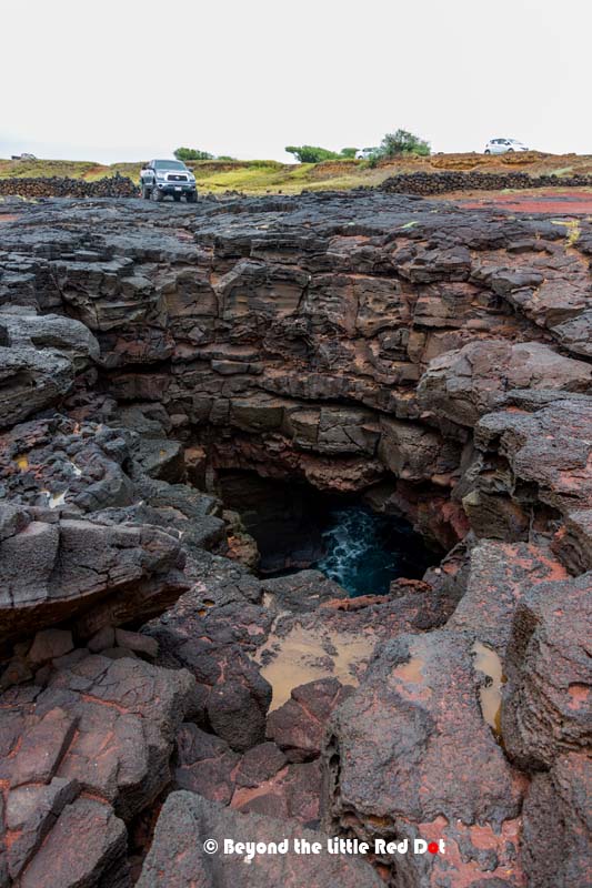
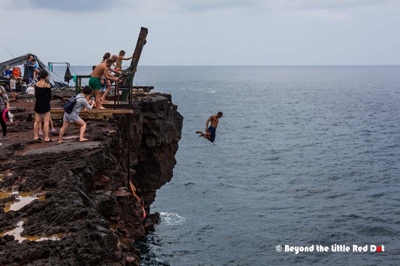
South Point
The next morning we checked out from our Airbnb and started to drive towards Volcanoes National Park (VNP) where we would spent our second and last night on Big Island. It takes around 3 hrs to drive from Kailua-Kona to VNP. Along the way there are several sights where you could stop for some sight seeing. However, due to our shortened plan, we decided to stop only at South Point, bypassing the Captain Cook Monument and Pu‘uhonua o Hōnaunau National Historical Park.

South Point is the southernmost point in the USA, and here you can see people cliff diving into the ocean From here you can see the whole South Pacific Ocean and there is no land mass all the way south from here until you reach Antarctica.


Further east of South Point is Green Sand Beach. The sand here is green due to the olivine mineral which gives the sand it’s green color. We didn’t go see this beach as we would need to hike 2.5 miles one way from South Point and we didn’t have the time to do that. If you are interested to get there, here is a blog post about it.
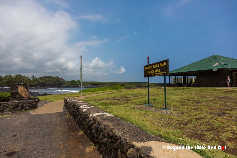
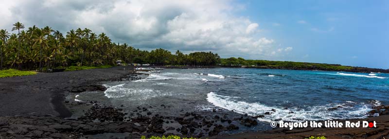
Black Sand Beach
After taking in the action at South Point we continued on and passed by a black sand beach at Punalu’u. It’s a really small beach and we didn’t spend much time there.

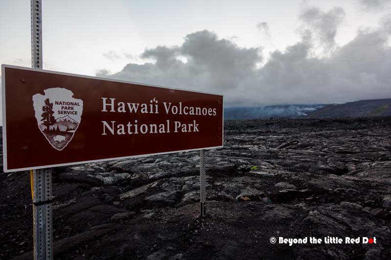
Volcanoes National Park
This is the premier park that you should visit when you are in Big Island. You will be close to the erupting crater of Kilauea which has been active for the last 2,000 years. We only reached VNP in the late afternoon and checked into our hotel at Volcano Village. The main village center consists of some restaurants, small shops, petrol kiosks and a post office which are all sparsely laid out. The various hotels, inns and lodgings are spread out over the village. Walking is not really a good option and you need to drive around just to visit the village center to get something. There are also several farms and artists’ studios around. VNP and Volcano Village is also at 3,500 ft above sea level, and can get really chilly at night. So remember to bring warm clothing. We were also surprised that our hotel room did not have air-conditioning and was stuffy in the day, but at night it was really cold.
Volcano Village is around 1 mile away from VNP and it’s the closest place to stay if you want to visit the park. There is a hotel within the park, but it’s usually full and quite expensive. Otherwise, the next closest place to stay is Hilo which around 1 hour’s drive away from VNP. The entry fee for VNP is US$20 per car (and everyone in it) and is valid for 7 days. The park is really huge and driving is the best option to get around. As this is an active volcanic area, at times volcanic smog (the locals call it vog) will be covering the land like haze, but with a rotten egg smell, so you have to get used to it. It’s not like your companion farted in the car.
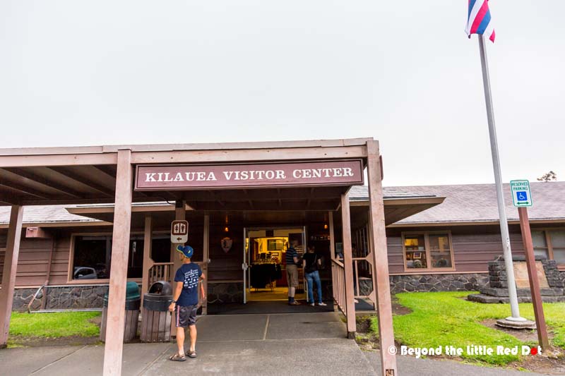
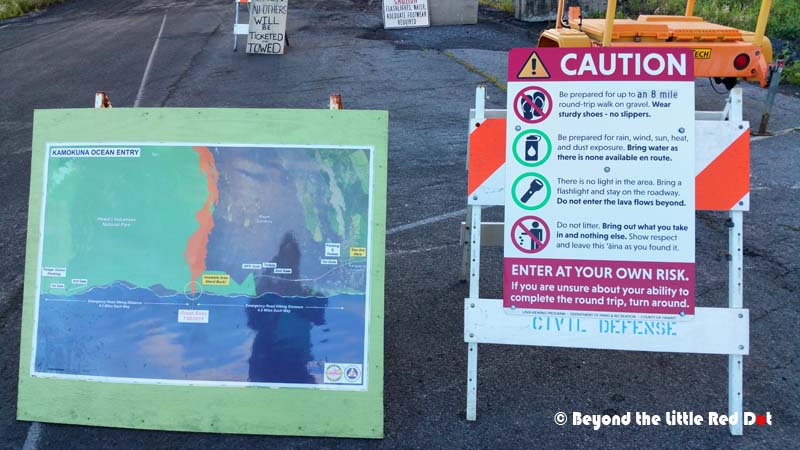
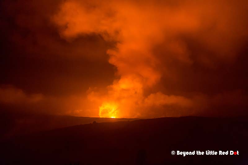
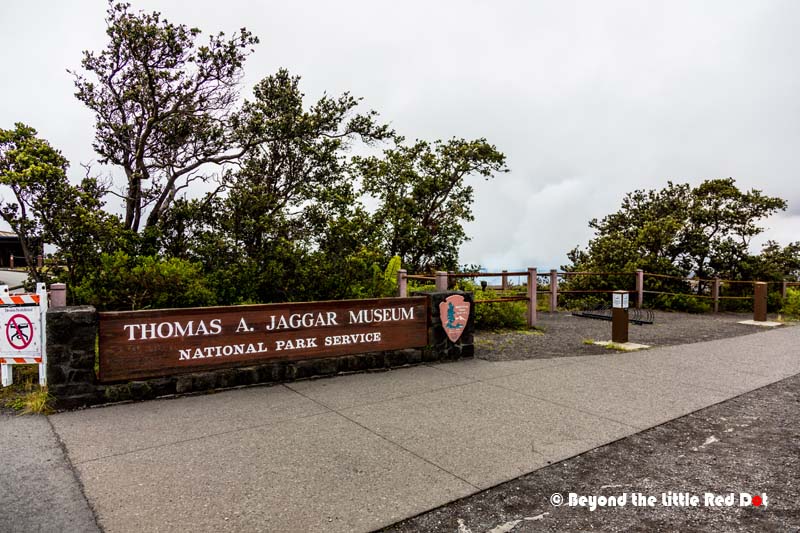
Your first stop in VNP should be the Visitor Center, where you can find out the latest information, sign up for guided tours, or watch documentaries on the volcanoes. The park rangers here are really helpful and we learnt from one of them how to get to the spot to watch lava flowing into the ocean. Lava had only started to flow into the sea since July this year, and it was a rare chance to see such a phenomena. By this time it was already late afternoon and we rushed back to our hotel to get our stuff and drove off towards Kalapana where the lava flow was.
It’s a 1 hr drive from Volcano Village to Kalapana, and we also loss some time getting lost, but in the end we found the place and parked our car.


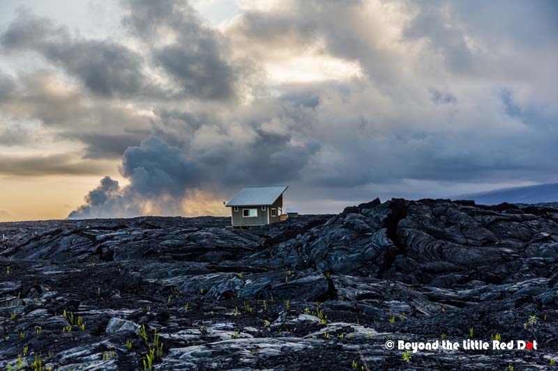


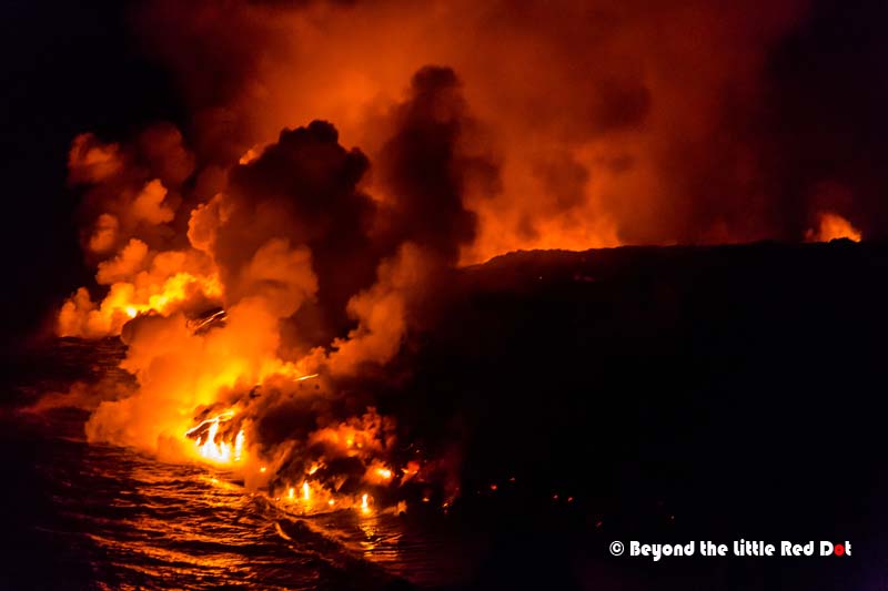

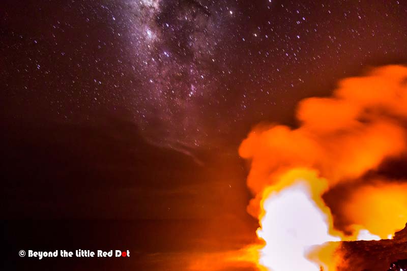
Although the lava destroys property, it also creates new land as it flows into the sea. The lava flows slowly increase the size of Big Island over the years. This process of destruction and creation is what makes up our planet. After spending about an hour mesmerized by the power of nature, we reluctantly decided to leave. We had another 2 hrs hike back to our car, and another 1 hr drive back to Volcano Village. What else could happen? Well, we were 3/4 of the way walking back when it started to rain rather heavily. Although we had an umbrella and raincoat, our pants and shoes were all soaked. What a way to end the night. I also did a short video of the hike to the lava flow and it shows video footage of the lava.
If you want to see the lava flow, here are some of my thoughts. Go towards the evening, probably around 4pm when it’s less hot. You want to reach the lava flow area before it gets dark (sunset is around 6.30pm). The reason is that you have to walk over uneven solidified lava and it’s easier to do that while it’s still bright. The lava is black and even with a torchlight it can be difficult to see where you are going. The solidified lava is also like glass, and falling on it is going to be very disastrous, as it’s like falling on glass splinters. I cut my palms just by pressing onto the lava when I lost my balance. For photographers, bring your tripod and a telephoto lens, as you will be still a distance from the lava and a telephoto lens is great for close ups. Getting there early also ensures that you capture the lava during blue hour, something which I missed out on. You will also need a torchlight to see your way out after dark as the road is not lighted, and remember the rain gear. The hike should take you around 2 hrs (1 way) or shorter if you walk faster. If you want to see the lava only in the day time then you won’t be able to see the glow unless you get really close to the lava (as in a few metres away), but be prepared for the heat and volcanic fumes.
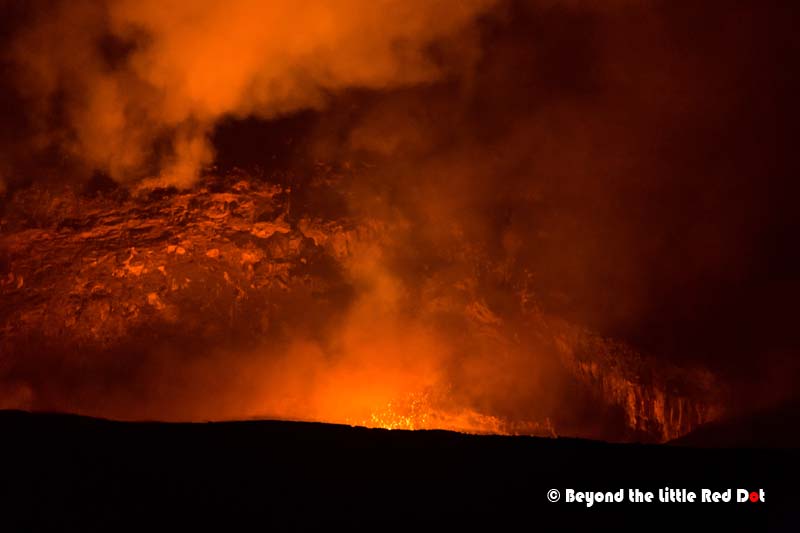
So we got back to our hotel at Volcano Village and changed out of our wet clothes. VNP is opened 24 hrs and we could still visit the park even though it was already past midnight. So what can you see in the night at VNP? Kilauea is still active and a lava lake lies inside it. Only at night can you see the glow of the lava in the crater. The level of the lava lake rises and falls depending on volcanic activity, and this time it was quite high. Since this was our last night, we had to see it.
The next morning we checked out and made our way to VNP for the very last time. But it was a rainy morning, and kind of a disappointing end to our visit. Maybe it was a parting gift from Hurricane Lester as it spun it’s way northwards away from Hawaii. I understand from the people here that rainy weather is quite common in this area, so be prepared for rainy weather when you are here.


We drove down the Chain of Craters Road and it began to rain again. Due to the heavy rain in the higher altitudes, we skipped the Thurston Lava Tube, and drove all the way to the end of the road where the Holei Sea Arch was. At least it was not raining down at the coast.


After looking at the Holei Sea Arch, we had to backtrack through the Chain of Craters road back to the Visitors Center. There are several old craters and lava flows along the Chain of Craters road, but the rain prevented us from coming out of the car to view them. So we decided to continue all the way to Hilo and take the Saddle Road back to the west coast.
Waikoloa Beach Resort
It rained the whole time we drove to Hilo and even when we were driving on Saddle Road westwards, it continued to rain. The rain only cleared up when we were on firmly on the west and driving towards Waikoloa. So we have experienced the micro weather system on Big Island ourselves.
Waikoloa is an area where the beach resorts are built and is located on the north west coast of Big Island. You will find Marriot and Hilton, along with several other luxury hotels and golf courses here. If you are the type that prefers luxury hotels along the beach then this place is for you. We decided to stop here as there is a small village center that has restaurants, shops and a supermarket for the residents staying here. Actually, there are 2 such village centers. The one we visited is called the Queen’s Marketplace, and there is the other village center that is called the King’s Shops. Waikoloa is also near the airport and has a gas station to top up our rental car before we returned it. So we had our dinner here and did some quick shopping before heading to Kailua-Kona Airport for our flight back to Honolulu.
As we had shortened our trip, we missed out on the attractions on the eastern side of Big Island like the Rainbow Falls, Akaka Falls, and Waipio Valley. Some of the activities that we also missed were the night dive/snorkeling with manta rays, or swimming with dolphins. There is also Waimea where the largest cattle ranch in the USA used to be, and you can try being a cowboy riding horses.
Safety
Again the same rules apply as from Oahu. Never leave your valuables in plain sight when you park your car. Car break-ins are also common here and there are more secluded carparks here compared to Oahu due to the lower population density.
The speed limit on most of the highways is 45-55 mph, but many people like to speed. I noticed on many occasions that the police were having a field day pulling drivers over for speeding, especially on Saddle Road. The police drive in unmarked cars, and many cars just speed past them without realizing it’s a police car, then suddenly the red and blue lights come on and you are screwed. So if you don’t want a speeding ticket, keep to the speed limit.

Great post on Big Island – inspiring and I love the photos! I didn’t have the chance to visit Big Island on my Hawaii trip, but I’m hoping to go back one day. I’ve never tried photographing the Milky Way, either, since over here (Finland) it’s either too cold to stay outdoors (winter) or too light to see stars (summer). So next time I go somewhere tropical, that’s on my list! That lava looks amazing, kind of scary, too! Your post made me dream of lovely Hawaii and remember what it was like there, so thanks for that! 🙂
We in the tropics would kill to be in Finland to watch the aurora every year. Haha!
I’ve never seen the aurora!! It’s always too cloudy in Helsinki or too light. And cars are so expensive here that we can’t afford one, to drive further away to look at them! So nothing to envy, really! I dream of seeing the Northern Lights, too! 😄