The archipelago of Langkawi lies on the northern most end of the west coast of Peninsula Malaysia. A quieter alternative to islands like Bali or Phuket, its this lack of mass tourism that gives Langkawi its laid back charm. I had not visited Langkawi for more than 10 years until December 2025 when I made a visit again.
In the present day, Langkawi is best known for its beach resorts and duty‑free shopping, easily reached by flights from Malaysia and Singapore or by ferry from the mainland. Yet long before tourism and duty free malls, this archipelago lay on the fringe of the ancient super‑continent Gondwanaland more than 550 million years ago. Over time, plate tectonics drove the rocks that would become Langkawi into the super-continent, building the foundations of mainland Southeast Asia. As these rocks were compressed and uplifted, mountain ranges slowly rose from the seabed under immense pressure from within the Earth.
One of Langkawi’s most distinctive features is its status as a Global Geopark, recognised for preserving one of Malaysia’s most complete Palaeozoic rock records, from the Cambrian to the Permian. During my stay, I managed to visit all three of its celebrated geoforest parks.
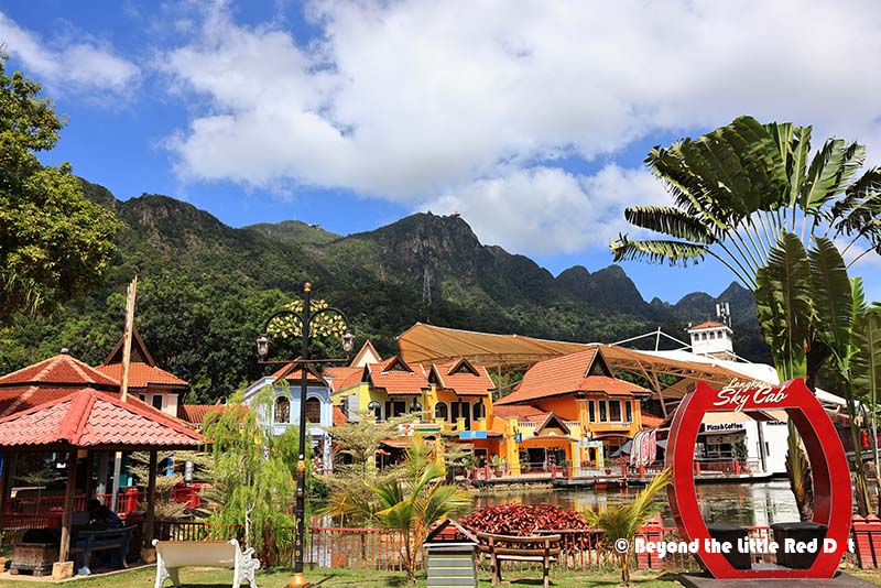
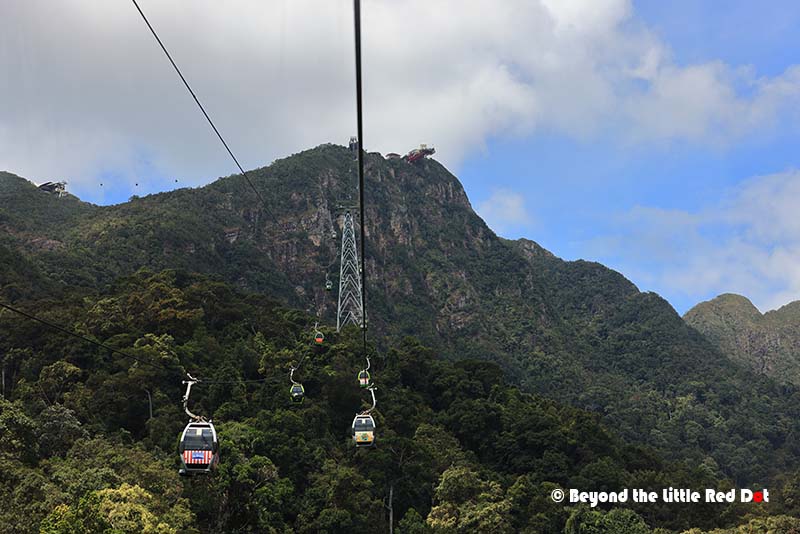
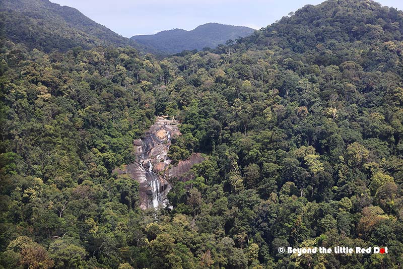
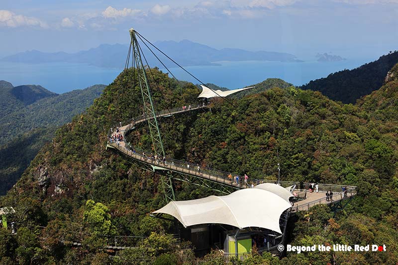
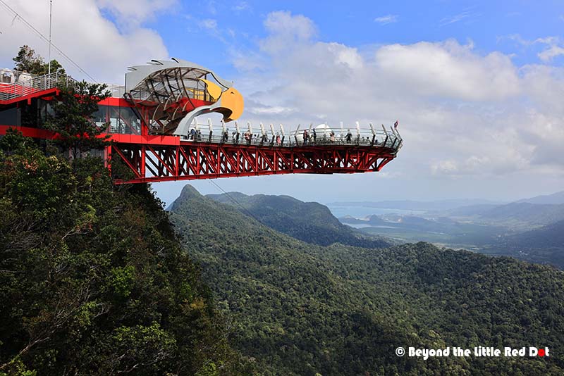
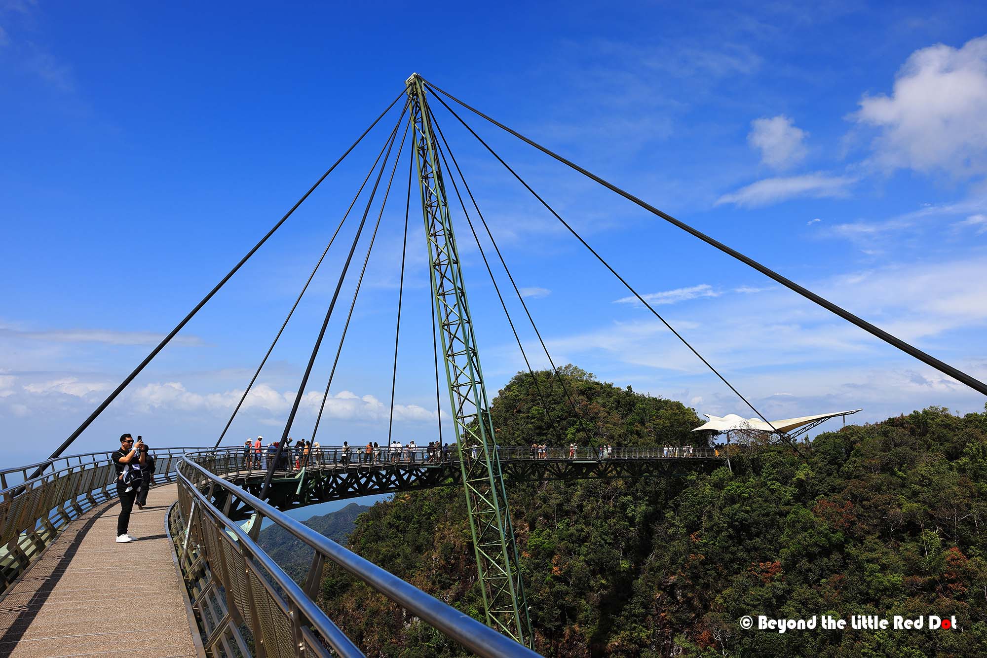
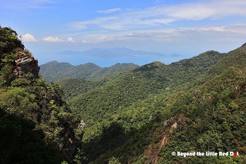
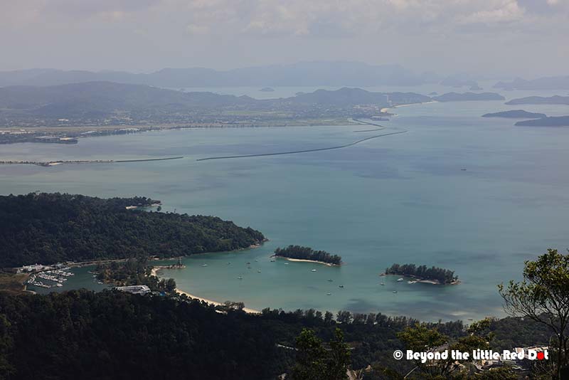
Skybridge and the Machinchang Mountains
Most visitors will visit the Langkawi Skybridge as this is the most marketed and iconic attraction on the island. Below the futuristic Skybridge also lies the Machinchang mountain range which contains the oldest rock formation in Malaysia dating back to the Cambrian period. These mountains started as ancient river and sea beds more than half a billion years ago, later uplifted and tilted as the region’s tectonic plates collided and shifted.
Kilim Geoforest
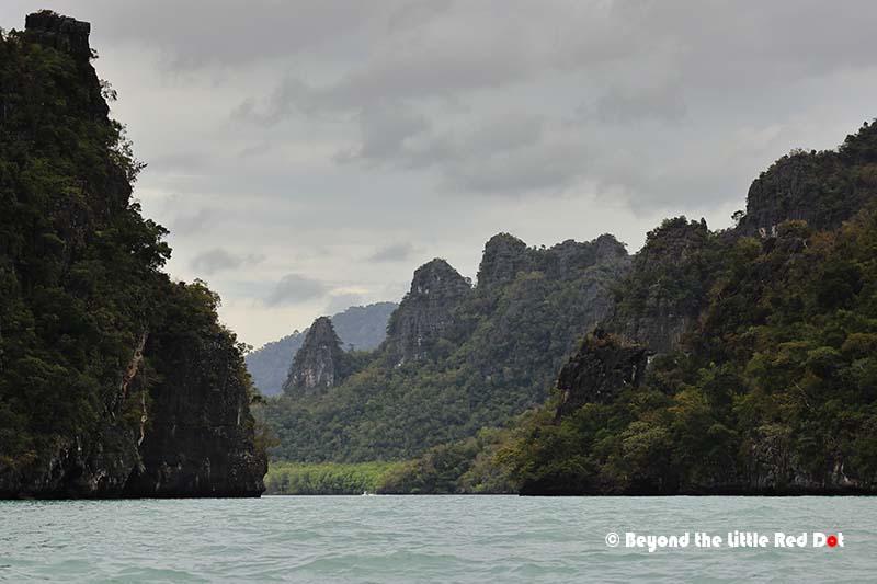
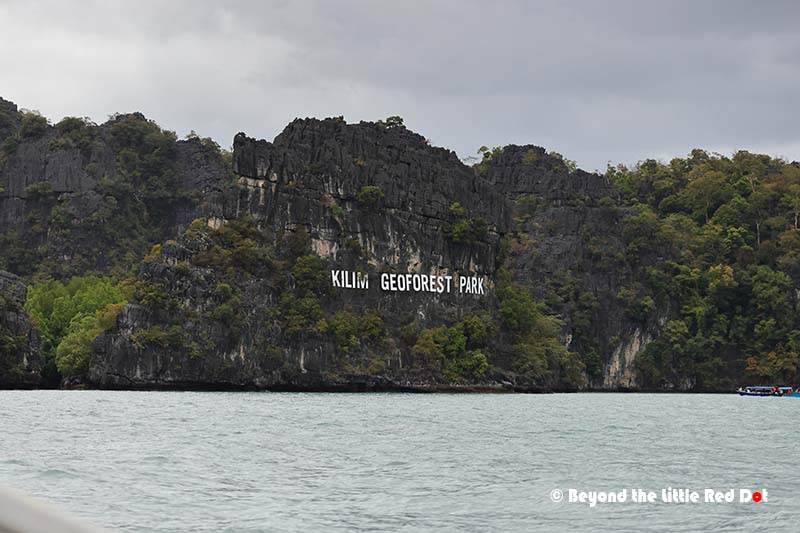
Kilim Geoforest Park lies on the northeast of Langkawi and was awarded Global Geopark status in 2007, making it one of the first sites of its kind in Southeast Asia. The only way to experience this landscape is by boat, which you can hire directly from the jetty at the visitor centre. Several tour options are available, typically ranging from two to four hours. We opted for the two‑hour trip at MYR 350 for a private boat, which is ideal for larger groups since each vessel can accommodate up to 10 adults.
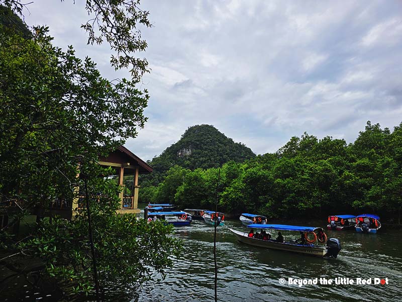
I would say that the Kilim Geoforest Park should not be missed if you visit Langkawi. Its at least a 45 minutes drive from Kuah Town or Cenang Beach, and its best to get here early in the morning to beat the tourist crowds and afternoon heat.
Dayang Bunting Marble Geoforest Park
Off the main island of Langkawi in the southeast is the Dayang Bunting Marble Geoforest Park. This consists of several large and smaller islands which can be reached by boat tours. For ourselves, we took a jet ski tour which is quite fun and exciting as we had to ride and steer jet skis over open sea and waves.
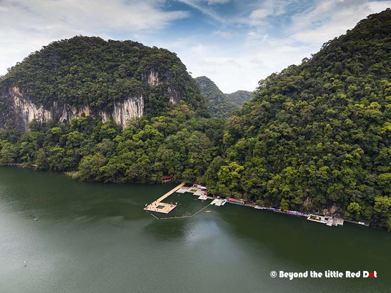
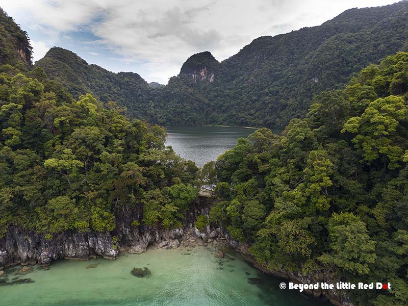
The main attraction is the island of Pulau Dayang Bunting or Island of the Pregnant Maiden. This is the second largest island in the archipelago and it has a freshwater lake surrounded by limestone mountains and shrouded in legend. Local folklore says that women who want to have children should bathe in this lake.
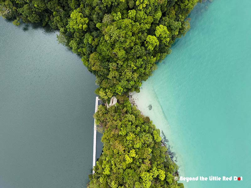
Geologically, the lake was formed millions of years ago when a large limestone cave collapsed forming a sinkhole that gradually filled with rain and groundwater. The unique feature of this lake is that there is narrow land barrier that separates it from the sea. Fresh water and salt water form two different coloured water bodies side by side.

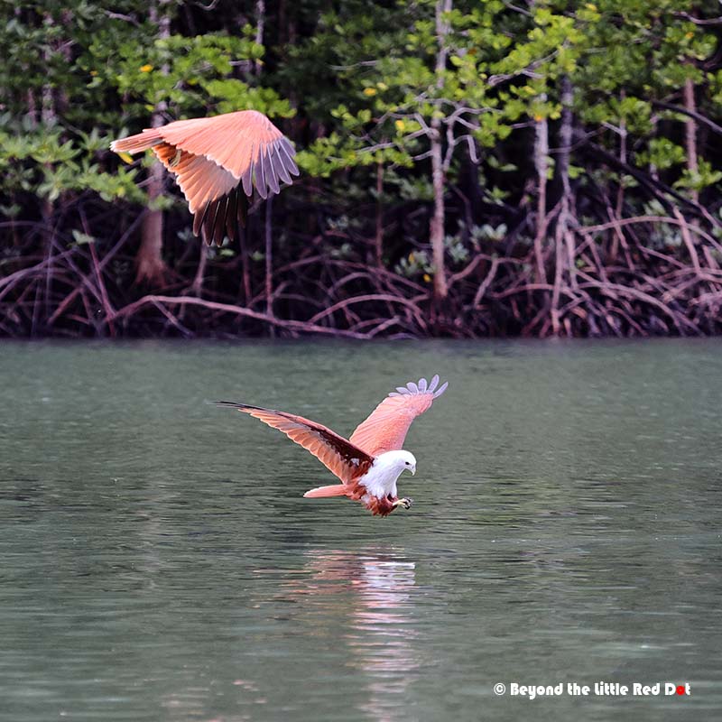
Wow, what a place… and an incredible series of images to show, and for me, the highlight: the eagles swooping down to hunt for fish. The beauty of nature.
It was quite interesting to watch the eagles catching fish. They swooped down one by one like a buffet queue.